TechForSpace had the opportunity to present one of its current projects (see here) while attending the EO OPEN SCIENCE 2016 conference, that has been organized by ESA on 12-14 September in ESRIN (Frascati, not far from Rome) where the ESA Earth Observation main activities are concentrated. This meeting allowed the Earth Observation scientists to meet and discuss about the current activities in the domain of Earth Observation open science and its future opportunities. Earth Observation is a very active field of study that concerns environmental monitoring and the global impact of human activity on the Earth. Its main applications are represented by the increasing number of Earth Observation (EO from now) satellites that are currently operating in space. This conference was the occasion to know the ESA activities that are helping to exploit the data provided by EO missions like the Sentinels, with a particular attention to the open science approach.
Various themes have been discussed during the three days dedicated to the meeting and whoever wants to know about all the topics and the related talks can find the full set of presentations here. A meaningful selection of them will be shortly described here, together with some interesting applications that were presented in the main sessions of the conference.
New Era for Open Science
The first session showed how Open Science can be useful to Earth Observation in different ways, by providing new applications and platforms to exploit the large EO data archives currently available, or involving citizens to collect data on the ground, in order to obtain more detailed maps to prevent or reduce different types of environmental hazards. Among all the interesting presentations, a noticeable initiative is surely Sentinel Hub, a new platform for Sentinel-2 applications that will provide valued added services for EO data users. Here is a very effective example of this technology.
Open Innovation and Tools
Various open tools with innovative approaches were presented during this session, including both offline applications and web-based interfaces that will help study the increasing amount of available EO data. An important example from this point of view was the presentation of the WMT(Wildfire Management Tool), an open source software application, used both in the USA and Europe, that can provide an analysis of the potential fire behavior and visualize the areas of risk. WMT uses the NASA WorldWind SDK, an open source virtual globe based on the US satellite imagery and other sources of geospatial dat
Citizen Science
New perspectives have been recently opened for Citizen Science, thanks to the widespread presence of IT technologies in everyday life. The large amount of data usually generated by smartphones or other high tech products can be integrated with typical EO data, to get results that can describe the environmental phenomena with better accuracy.These ideas were clearly summarized in the presentation of Cloopsy, a crowdsourcing mobile app to support and integrate Copernicus land cover mapping.The interesting aspect of this project is the use of geocoded pictures (pictures providing the latitude/longitude coordinates of their location) captured by smartphones for the validation of automated production results from Sentinel imagery. It is an effective example of how European citizens can be actively involved in a scientific research project.
Virtual Research Environment
In this session various projects of virtual research environments were presented, covering different aspects in the EO domain, from the presentation of an efficient data cube structure to the development of an innovative platform for Open Big Earth Observation Data analytics This project in particular deserves to be underlined because its intention is to improve the extraction and validation of land use and cover information from big EO data that are partially exploited in current research and operational applications.
Education/Visualization
Open Science is helping define interesting and innovative educational projects in many countries, where more and more students are constantly involved in new EO learning activities. In some case they also have the opportunity to play an active role in current scientific research. A particularly relevant project is SAR-EDU, a German educational initiative that aims to provide, share and communicate the Radar Remote Sensing knowledge, as a fundamental instrument for the EO sciences.
Platforms
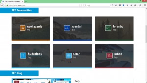
The last session of the conference introduced a series of innovative platforms that could be better defined as “virtual workspaces” where processing resources are remotely available for the users, avoiding operations like data storage or downloading, that are particularly critical in the case of EO data.The ESA initiative in this domain, called TEP (Thematic Exploitation Platform), was presented describing some of its specific sections, because each of them is dedicated to a different EO subject.

